

3 Inspiring Bike Adventures That Started with Just a Map
There's something magical about unfurling a map, tracing your finger along unknown roads, and imagining what might lie beyond the next bend.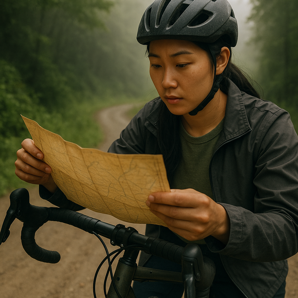
For cyclists with wanderlust in their hearts, a map represents more than navigation—it symbolizes freedom, possibility, and the promise of discovery. In a world increasingly dominated by GPS and pre-planned routes, the humble map remains the ultimate invitation to adventure, offering both direction and the delicious potential for getting wonderfully lost. As more cyclists hit the roads in 2025, being well-equipped and prepared is vital—see our guide to best anti-theft gear for bikers.
These three remarkable cycling journeys prove that extraordinary experiences often begin with the simplest of tools: just a map and the courage to follow where it leads. Each story showcases how different riders—solo travelers, groups of friends, and endurance athletes—transformed lines on paper into life-changing expeditions that tested their limits, expanded their horizons, and forever changed how they view the world from two wheels.
How the right map can spark a bike adventure
Maps occupy a unique space in the adventure cyclist's toolkit—they're simultaneously practical tools and portals to possibility. Whether it's a waterproof paper map stuffed into a jersey pocket, a GPS route loaded onto a cycling computer, or even a route sketched on a cocktail napkin after a night of enthusiastic planning with friends, maps provide both structure and inspiration.
For many cycle travelers, the perfect map strikes a balance between providing necessary guidance and leaving room for spontaneous exploration. Too much detail can eliminate the thrill of discovery, while too little might lead to frustration or safety concerns. Veteran route planners often recommend using maps as frameworks rather than rigid instructions—identifying key waypoints, potential rest stops, and alternate paths while allowing for detours when something interesting catches your eye.
Beyond practical navigation, maps connect cyclists to a rich tradition of exploration. Legendary bicycle tourists like Dervla Murphy, who documented her 1963 journey from Ireland to India in "Full Tilt," or Mark Beaumont, who circumnavigated the globe in record time, all began with simple route planning and the willingness to pedal into the unknown. Their journeys remind us that cycling adventures are as much about the mental journey—overcoming doubt, embracing uncertainty, and developing resilience—as they are about physical terrain.
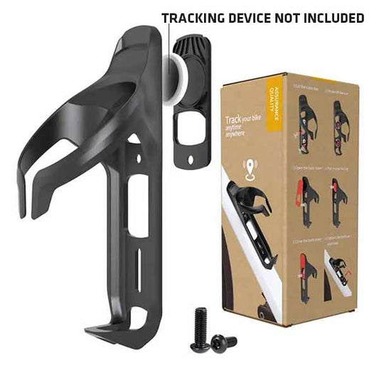
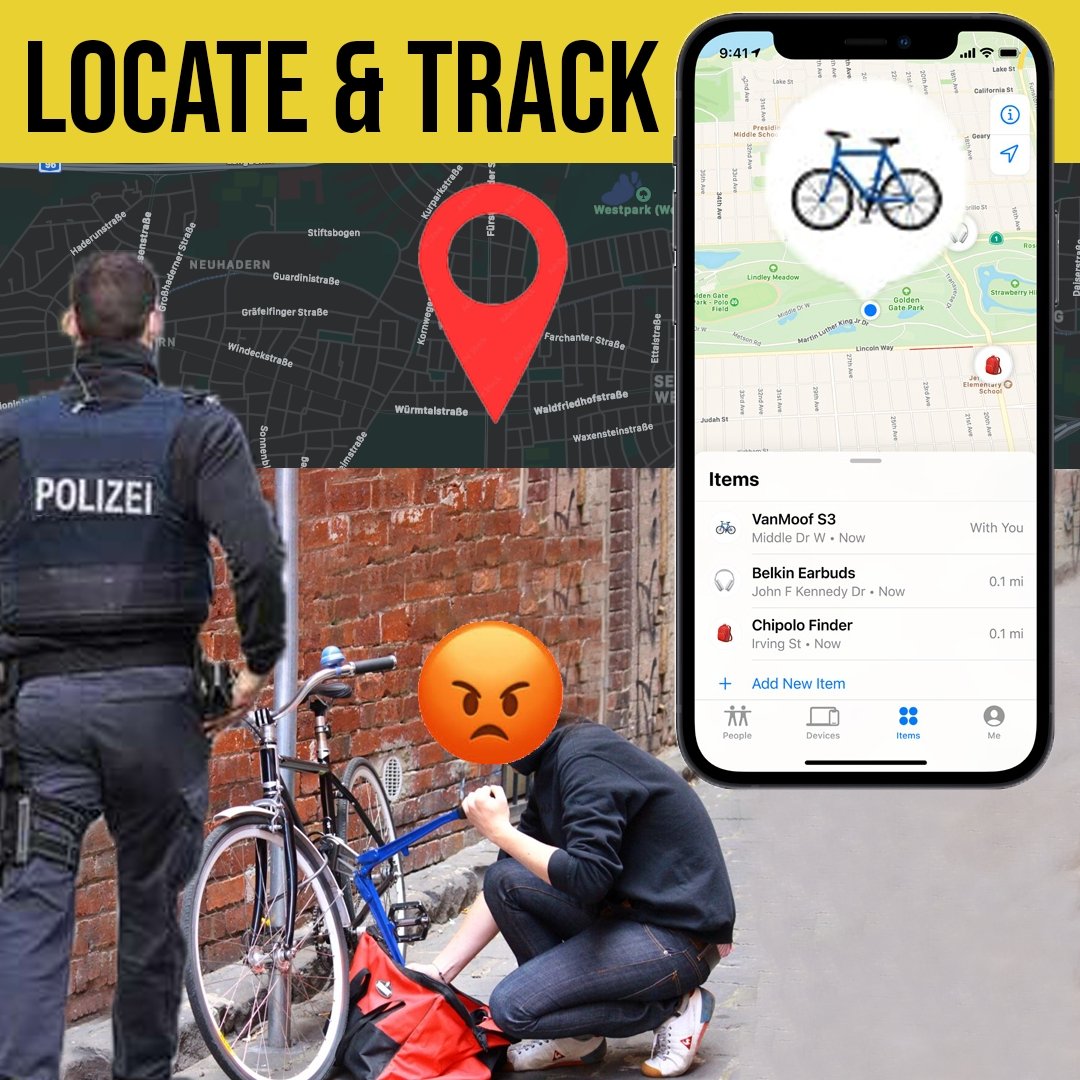
Before embarking on your own map-led cycling adventure, consider investing in tools that will protect your bicycle during those inevitable moments when you need to step away to explore. For those worried about protecting their bike while planning big journeys, check out discreet Airtag bike mounts for cyclists.
Adventure #1: Discovering uncharted roads — A solo bikepacking story
Sarah Chen never considered herself particularly adventurous. As a software engineer from Portland, her cycling experience consisted mainly of weekend group rides and the occasional charity event. But after finding an old forest service map at a yard sale, something changed. The faded paper showed a network of decommissioned logging roads throughout Oregon's Willamette National Forest—paths not visible on any digital platform.
"I kept unfolding that map for weeks," Sarah recalls. "It showed routes that seemed to have vanished from modern navigation. I became obsessed with the idea that these forgotten paths were still out there, waiting to be rediscovered."
With minimal bikepacking experience but abundant determination, Sarah prepared for a week-long solo journey. She equipped her gravel bike with frame bags, tested camping gear in her backyard, and researched water sources along her planned route. Most importantly, she marked potential bailout points—places where she could exit to main roads if conditions became unmanageable.
The first day delivered immediate challenges. Many trails were overgrown, requiring Sarah to hike-a-bike through sections thick with vegetation.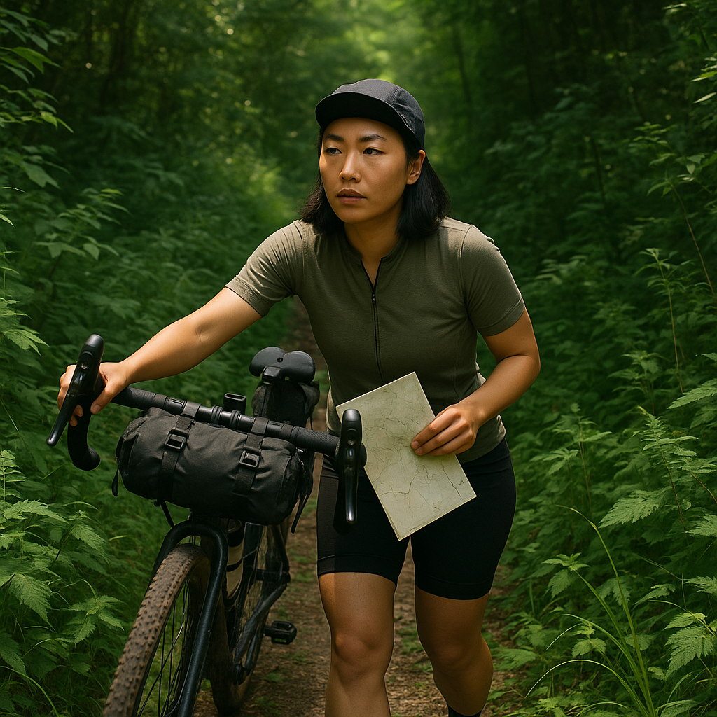
By evening, she had covered only half her planned distance, forcing her to reassess her entire schedule. Rather than becoming discouraged, she embraced the slower pace, learning to navigate by terrain features when trail markings disappeared.
"The third day, I found this perfect stretch—about twelve miles of smooth dirt road that wasn't on any digital map. It followed a ridge with views of three different mountain peaks. Not another soul in sight. That moment justified everything—the planning, the struggle, the uncertainty."
Sarah's journey became progressively more rewarding as she developed confidence navigating by map alone. She discovered abandoned fire lookouts, hidden alpine lakes, and wildflower meadows that few cyclists ever witness. The physical demands—climbing steep grades with a loaded bike and managing technical descents—pushed her skills beyond what she thought possible.
Perhaps the most valuable lesson came from navigating by intuition when map details proved insufficient. "When you're alone in the forest with just a paper map, you develop a different relationship with your surroundings," Sarah explains. "You start noticing subtle details—how the terrain flows, where water naturally runs, how animal paths often reveal the easiest routes. These aren't things you learn when following a blinking dot on a screen."
For those inspired by Sarah's journey, she recommends several safety precautions for solo bikepacking: always carry a personal locator beacon, share your route details and expected check-in times with multiple trusted contacts, and pack both digital and paper navigation backups. Most importantly, she suggests starting with shorter overnight trips to build confidence and test gear before attempting longer expeditions.
Adventure #2: Group ride across borders — Friendship and resilience
What began as a casual conversation among five college friends evolved into an ambitious plan: cycling through three European countries over three weeks, following a route outlined on a vintage touring map purchased at a secondhand bookstore. The friends—Marco, Elise, Javier, Tabitha, and Kwame—were experienced cyclists but novice tourists, making their cross-border journey from Amsterdam to Vienna both thrilling and daunting.
"We chose an outdated map intentionally," explains Elise, who proposed the trip. "We wanted that sense of mystery, to discover how landscapes had changed since the map was printed. Plus, it forced us to interact more with locals rather than relying on technology."
Their preparation involved weekly training rides, language practice, and equipment testing, but nothing could prepare them for the realities of group dynamics on the road. Just three days into the journey, conflicts emerged over pace, daily distances, and comfort priorities. Some preferred camping to maximize their budget, while others advocated for hostels and proper showers. The turning point came during a torrential rainstorm in rural Germany when Kwame's derailleur broke miles from the nearest town.
"We huddled under this tiny gas station awning, soaking wet, with a broken bike and no cell service," recalls Tabitha.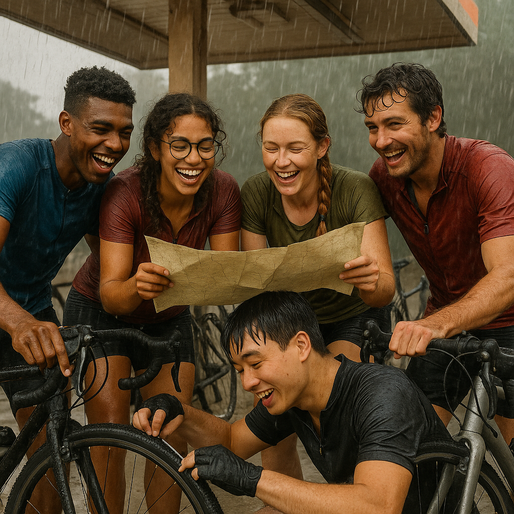
"That's when we really became a team. Javier, who knew bike mechanics, got creative with a makeshift repair. Marco, our German speaker, convinced a local farmer to drive Kwame to the nearest bike shop. The rest of us reorganized the gear to distribute Kwame's load until we could reunite."
This crisis established their pattern for the remainder of the trip: flexible planning each morning around a paper map, with roles assigned based on individual strengths. Javier became their maintenance specialist, Marco handled accommodations, Elise navigated, Kwame tracked expenses, and Tabitha documented their journey through photography and journal entries.
The outdated map led to countless unexpected discoveries—a monastery in Belgium that had been converted into a craft brewery, a forgotten war memorial in a German forest, and a festival in a small Austrian village where they were invited to join celebrations and given places to stay with local families.
Perhaps the most significant challenge came at the Austria-Czech Republic border, where their intended crossing point no longer existed for cyclists. Faced with either a 60-mile detour or an extremely steep mountain pass not designed for loaded touring bikes, they chose the mountain. The eight-hour ordeal—much of it pushing bikes up switchbacks in summer heat—tested every relationship.
"We said some things that day that required apologies later," Marco admits. "But making it over that pass together created a bond that's lasted years beyond the trip. When any of us faces a challenge now, someone inevitably says, 'Remember the pass? We can handle this.'"
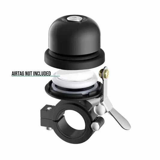
Beyond the physical journey, the trip transformed how each rider approached challenges in their everyday lives. They learned to communicate needs clearly, accommodate different paces, celebrate small victories, and approach obstacles collaboratively. Before heading out in a group, it helps to know how to outsmart bike thieves—the hidden power of Airtag mounts for cyclists is worth considering.
Seven years later, though scattered across different countries, the group still reunites annually for shorter cycling adventures—always with a paper map leading the way.
Adventure #3: Ultra-endurance cycling—Chasing boundaries and breaking limits
Miguel Ferreira had always been a competent recreational cyclist, completing century rides and weekend tours with relative ease. But the 52-year-old school principal never imagined himself as an ultra-endurance athlete until he discovered a weathered guidebook describing the historic Paris-Brest-Paris randonnée—a legendary 1,200-kilometer event first held in 1891, making it one of cycling's oldest organized rides.
"Something about those yellowed pages describing ordinary people riding extraordinary distances captured my imagination," Miguel explains. "The book showed simple route maps with checkpoints and time limits, but little else. The simplicity made it seem both impossible and somehow accessible."
With the next official Paris-Brest-Paris event three years away, Miguel created his own ultra-cycling challenge based on a regional map. He designed a 600-kilometer route through mountainous terrain near his home, planning to complete it self-supported within 40 hours—an ambitious goal for someone who had never ridden through the night.
Training consumed his life outside of work. Predawn rides before school, indoor training during lunch breaks, and progressive longer journeys on weekends slowly built his endurance base. Miguel learned the science of nutrition and hydration, experimented with various lighting systems for night riding, and researched the psychology of sleep deprivation.
"The map became my meditation object," Miguel recalls. "I'd study it daily, visualizing each section, planning where I might struggle, where I could recover. I calculated elevation gain for each segment and estimated times based on terrain. That mental preparation proved just as important as the physical training."
When the day arrived for his personal challenge, Miguel faced immediately challenging conditions. Unexpected headwinds slowed his progress, putting him behind schedule within the first 150 kilometers. Rather than abandoning his time goal, he adjusted his strategy—minimizing stops, eating more frequently while riding, and maintaining a sustainable effort level rather than fighting the elements.
The night section tested him profoundly. Alone on empty mountain roads at 2 a.m., battling fatigue-induced hallucinations and temperatures near freezing, Miguel confronted the fundamental question all ultra-cyclists eventually face: Why continue when stopping would be so easy?
"I remember checking my map by headlamp at around kilometer 400, my hands shaking from cold and exhaustion," Miguel says.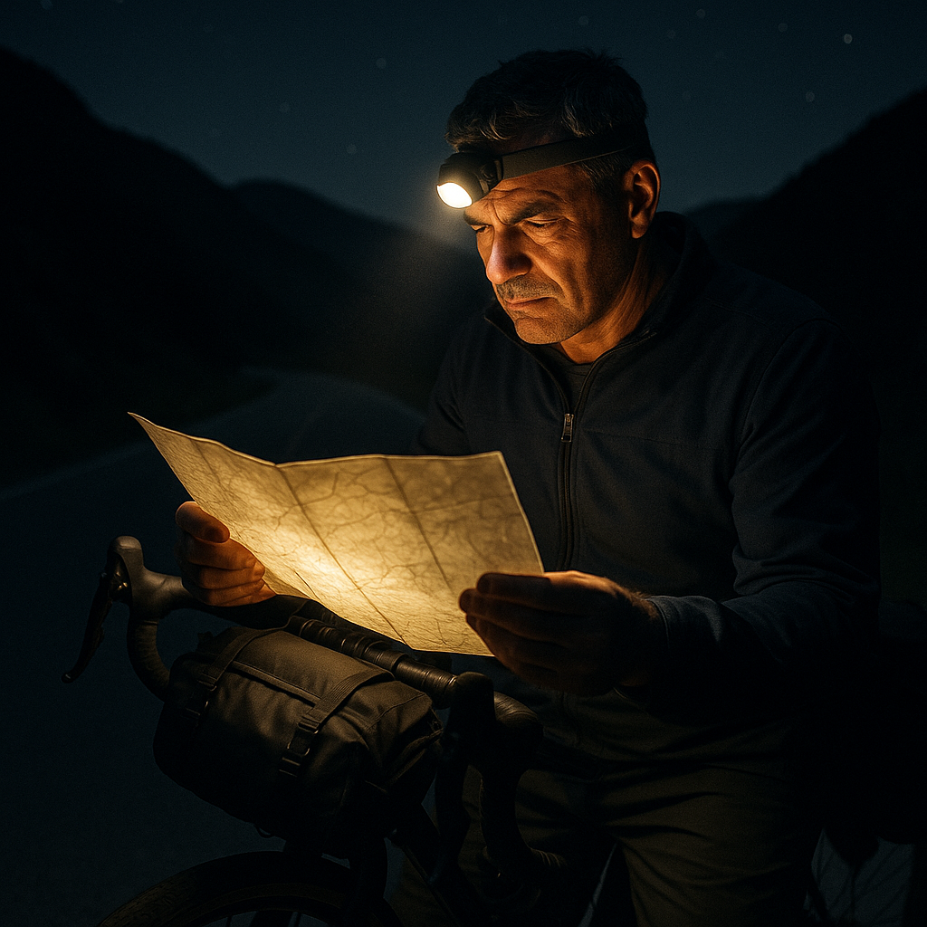
"The map didn't just show me where to go—it reminded me of all the preparation, all the visualization I'd done. Each highlighted section represented a promise I'd made to myself."
When Miguel completed his route in 38 hours and 17 minutes—almost two hours under his target—the achievement represented far more than physical endurance. He had discovered a capacity for suffering, problem-solving, and perseverance that transformed his self-perception. Two years later, he successfully completed the actual Paris-Brest-Paris event, one of cycling's most prestigious ultra-distance accomplishments.
For aspiring ultra-distance cyclists, Miguel emphasizes that mental training deserves as much attention as physical preparation. He recommends progressive distance building, practicing night riding in safe environments, and testing all equipment extensively before major events. If you're preparing for a multi-day event, securing your gear with a bike saddle mount with hidden security features can offer much-needed peace of mind.
"The map is just the beginning," Miguel reflects. "It shows you where you might go, but discovering what you're capable of—that's the real journey."
Conclusion
These three remarkable journeys—Sarah's solo exploration of forgotten forest paths, the five friends who strengthened bonds across European borders, and Miguel's transformation into an ultra-distance athlete—share a common origin: they began with nothing more than lines on paper and the courage to follow them into the unknown.
Maps offer more than directions; they provide permission to wonder, to wander, and to discover not just new territories but new dimensions of ourselves. In our hyperconnected age, where turn-by-turn navigation and real-time tracking are standard, choosing to follow a simple map represents a deliberate embrace of uncertainty and the magic that unfolds when we leave room for the unexpected.
Whether you're contemplating your first overnight bicycle tour or dreaming of a transcontinental journey, remember that every legendary cyclist started with that same combination of curiosity and slight trepidation. The distance between imagining an adventure and experiencing one is bridged by preparation, appropriate equipment, and the willingness to pedal that first mile.
Your map—whether digital or paper, detailed or impressionistic—awaits. The only question that remains is: where will it lead you?
Frequently asked questions
How can I plan my own map-led bike adventure?
Start by identifying inspiring routes, research potential risks, pick the right map format, and prepare for changing conditions. Travel light but bring essentials.
What gear do I need for a self-supported bike trip?
Must-haves include navigation tools (map/GPS), bike repair kit, secure locks, lights, and personal safety equipment. Consider anti-theft bike gear for peace of mind.
How do cyclists ensure bike security on long trips?
Use robust locks, consider hidden Airtag bike mounts, and never leave your bike unattended in high-risk areas.
Are group bike adventures easier to plan than solo trips?
Group rides offer shared navigation and moral support—but require consensus on pace, route, and logistics. Solo trips provide flexibility but demand full self-reliance.
What's the best way to start with ultra-endurance cycling events?
Begin with shorter distance events, gradually train for endurance, join community rides, and learn from experienced participants.