
Staying Safe on Remote Trails with Zero Cell Service
There's something magical about venturing deep into the wilderness where cell towers become distant memories and nature reigns supreme.
Remote trails offer unparalleled solitude, breathtaking vistas, and a genuine escape from our hyper-connected world. But this disconnection comes with significant challenges—when your smartphone can't connect to the outside world, your approach to safety needs to evolve.
Whether you're planning your first backcountry adventure or you're a seasoned wilderness enthusiast, understanding how to navigate, communicate, and respond to emergencies without cellular connectivity could make the difference between a rewarding experience and a dangerous situation. In this comprehensive guide, we'll explore essential preparations, gear considerations, navigation techniques, and emergency protocols that will help you confidently tackle trails beyond the reach of cell service.
Preparing before you hit the trail
The foundation of any successful backcountry adventure begins long before your boots touch the trailhead. Thorough preparation is your first line of defense when exploring paths without connectivity.
Trail research & difficulty assessment
Understanding what lies ahead is crucial for remote hiking safety. Start by researching your intended route through multiple sources:
- official land management websites (Forest Service, National Park Service, BLM)
- recent trip reports on platforms like AllTrails or Hiking Project
- topographic maps to analyze elevation changes and terrain challenges
- local ranger stations for current trail conditions and potential hazards
According to wilderness educators from the National Outdoor Leadership School, trails should be selected based on your current fitness and skill level, not aspirational abilities. Be honest about your experience and choose routes that match your capabilities when cell service won't be available to bail you out.
Leave a detailed trip plan
When hiking with no cell service, your trip plan becomes your lifeline to the outside world. Create a comprehensive itinerary that includes:
- exact route with alternates clearly marked
- anticipated timeline including daily mileage goals
- planned campsites or rest locations
- your "panic time"—when someone should alert authorities if you haven't returned
- vehicle description and where you'll park
Share this plan with at least two responsible individuals who will take action if you don't check in. Many search and rescue teams recommend the additional step of leaving a copy of your plan visible in your vehicle at the trailhead.
Permits & notifications
Many backcountry areas require permits or registrations, especially for overnight stays. These systems serve multiple purposes: they manage visitor impacts and provide authorities with valuable information should you need assistance.
When securing permits, also research:
- local ranger district contact information
- nearest emergency services to your route
- typical search and rescue protocols for the area
- seasonal considerations that might impact trail conditions
Creating backup plans for entry/exit points can prove invaluable if your primary route becomes impassable due to unexpected conditions—something particularly important when trail emergency preparedness is your responsibility alone.
Packing the right gear for off-grid safety
Remote trails demand specialized equipment that compensates for the absence of immediate assistance and technological connections.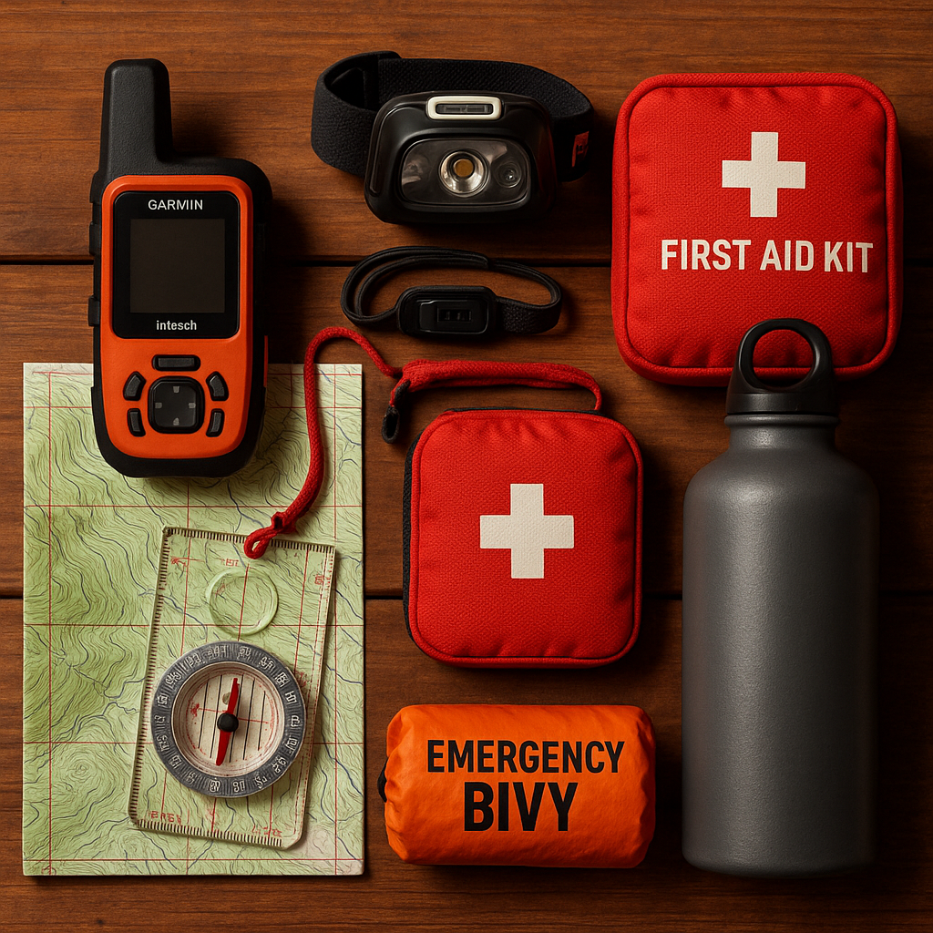
Emergency communication and SOS devices
When cellular networks disappear, dedicated satellite communication devices become your connection to emergency services. Unlike smartphones, these specialized tools operate on satellite networks with vastly broader coverage in wilderness areas.
Popular options include:
- Garmin inReach: Offers two-way messaging, location sharing, and SOS functionality with global Iridium satellite coverage
- SPOT Devices: Provides location tracking, pre-programmed messages, and emergency notification with one-way communication
- Zoleo Satellite Communicator: Delivers seamless messaging that transitions between cellular, Wi-Fi and satellite networks
- Motorola Defy Satellite Link: Transforms your smartphone into a satellite communicator with two-way text capabilities
These devices typically require subscription plans that vary in cost depending on features and message allowances. Many experienced backcountry adventurers consider satellite SOS devices for hiking an essential investment rather than an optional luxury—especially for solo travelers.
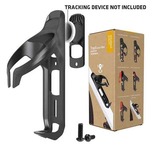
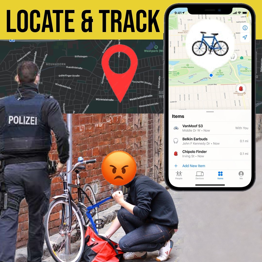
If you're exploring protection for your valuable gear while in the backcountry, consider how concealed GPS trackers can provide additional security. Some modern devices combine high-security locks with hidden tracking capabilities, offering peace of mind when you need to leave equipment at camp during day hikes.
The 10 essentials—off-grid edition
The classic "Ten Essentials" list has guided outdoor enthusiasts for decades, but remote trails require enhanced versions of these hiking essentials:
- Navigation: Paper maps, compass, AND downloaded offline digital maps (with backup battery)
- Illumination: Headlamp plus backup light source and extra batteries
- Sun protection: Sunscreen, sunglasses, hat, and protective clothing
- First aid: Comprehensive kit including medications and knowledge to use it
- Knife/repair tools: Multi-tool, duct tape, and gear-specific repair items
- Fire: Multiple ignition sources and waterproof tinder
- Shelter: Emergency bivy or tarp beyond your planned accommodations
- Extra food: At least one additional day's worth beyond your itinerary
- Extra water: Capacity to carry adequate amounts plus purification methods
- Extra clothes: Insulation layers that remain effective when wet
For remote hiking, experienced backcountry guides recommend adding these critical items:
- satellite communication device
- signaling tools (whistle, mirror, bright fabric)
- power bank for essential electronics
- detailed first aid instructions
- emergency contact information (even without service)
Pack distribution matters too—spread critical items throughout your gear rather than concentrating all essentials in one bag that could be lost or damaged.
Navigation without a mobile signal
The ability to find your way becomes significantly more challenging when your smartphone can't access mapping apps or GPS satellites effectively.
Paper maps & map-reading skills
Physical maps never lose battery power or break when dropped.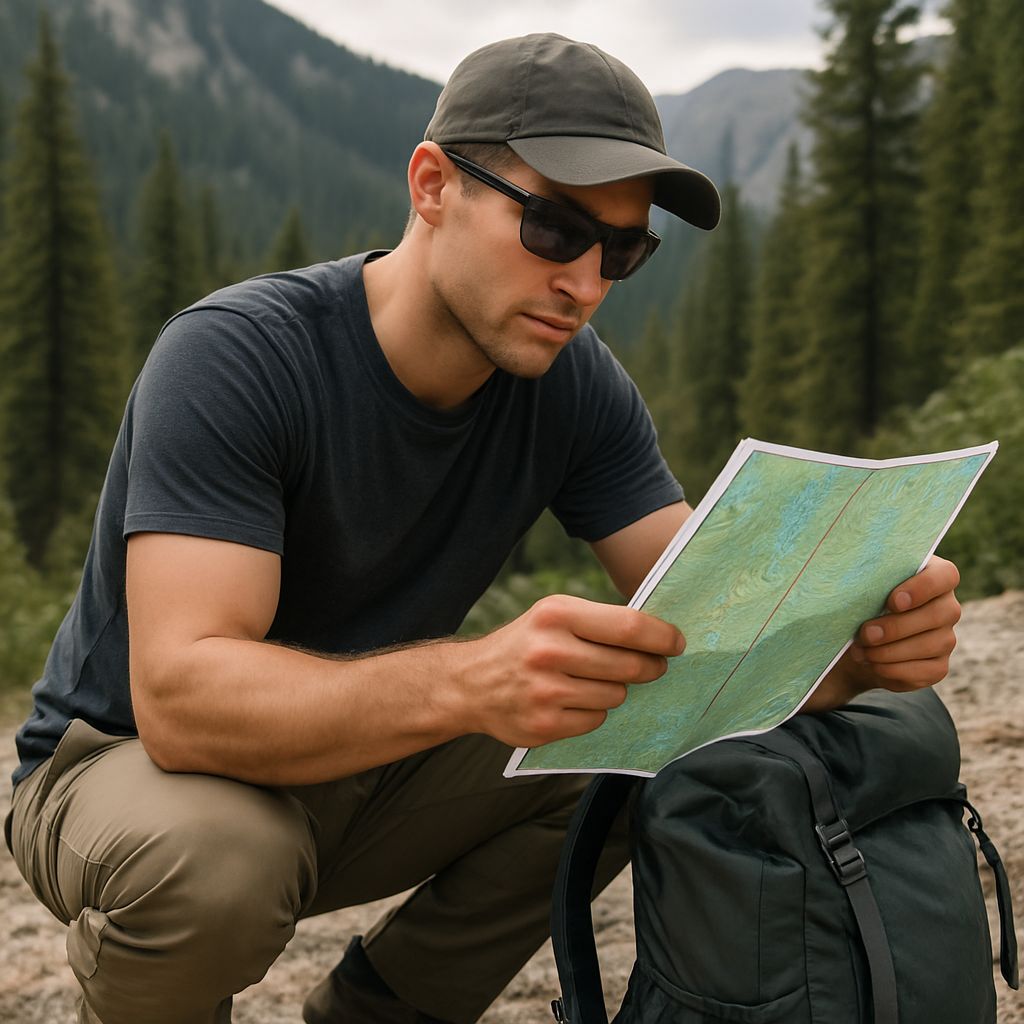
For backcountry navigation, invest in waterproof topographic maps that cover your entire route plus surrounding areas. Before departure, practice these essential map skills:
- understanding contour lines and terrain features
- identifying your location using landmarks
- measuring distances accurately
- plotting coordinates and bearings
Mark your planned route, water sources, campsites, and potential bailout points directly on your maps with a pencil. Keep maps accessible—not buried in your pack—and review them regularly throughout your journey to maintain awareness of your position.
Compass use 101
A quality compass becomes invaluable for staying found in wilderness when digital aids fail. Before your trip, master these fundamental compass skills:
- setting and following a bearing
- accounting for declination in your region
- triangulating your position using multiple landmarks
- navigating around obstacles while maintaining direction
Many outdoor education centers offer navigation workshops where you can practice these skills in controlled environments before testing them on remote trails. Consider carrying a backup compass—a small, basic model stored separately from your primary navigation tools.
Offline digital maps
While smartphones lose cellular functionality in remote areas, their GPS capabilities often continue working. Before departure, download detailed topographic maps of your region through apps like:
- Gaia GPS
- Avenza Maps
- AllTrails Pro
- OnX Backcountry
To maximize battery life, switch to airplane mode and dim your screen when checking location. Many experienced hikers use their phones primarily for confirmation rather than primary navigation, preserving battery for potential emergencies.
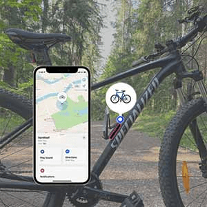
Just as tracking technology has evolved for cyclists with specialized AirTag mounts for bike security, hikers can employ similar location-awareness technology. These systems can help document your journey even without connectivity and provide valuable data should search and rescue operations become necessary.
Trail markers & environmental cues
Nature provides countless navigational indicators when you know what to observe:
- official trail blazes and cairns
- sun position throughout the day
- prevailing wind patterns
- vegetation changes with elevation or exposure
- distinctive terrain features compared to your map
Develop the habit of regular position confirmation—stop at junctions, distinctive landmarks, or hourly intervals to verify your location against multiple navigational tools. This practice prevents small directional errors from becoming significant deviations that could endanger your journey.
Managing hazards: weather, wildlife, and environmental risks
When traveling beyond cell service, you become fully responsible for anticipating and responding to natural hazards without external guidance.
Weather forecasting and microclimates
Remote areas often experience dramatically different weather than nearby populated regions, particularly in mountainous terrain. Before departure:
- study detailed forecasts from multiple sources
- research seasonal patterns for your specific location
- understand how elevation changes affect conditions
- learn to recognize warning signs of approaching storms
Pack weather-appropriate gear plus contingencies for unexpected conditions. Mountain weather can shift rapidly—warm sunshine can transform into hypothermia-inducing rain within minutes. According to experienced search and rescue teams, weather miscalculations rank among the most common factors in backcountry emergencies.
For critical gear that must stay dry regardless of conditions, waterproof protection cases provide essential security. Rain or shine, your emergency communication devices and navigation tools require maximum protection to remain functional when needed most.
Wildlife encounters: prevention & response
Remote hiking safety includes appropriate wildlife awareness. Research which animals inhabit your destination and understand proper interaction protocols. General wildlife safety on trails includes:
- making noise while hiking to avoid startling animals
- properly storing food using bear canisters or hang methods
- maintaining appropriate distances from all wildlife
- carrying deterrents appropriate for the region (bear spray in grizzly country)
Learn species-specific response protocols—what works for black bears differs from mountain lion encounters. Most importantly, remember that wildlife conflicts typically result from human behaviors that can be modified to promote coexistence.
Environmental hazards: stream crossings, loose terrain, and ledges
Natural features create significant challenges when hiking with no cell service.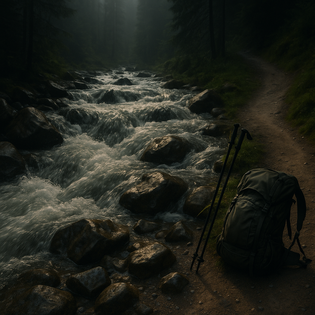
Approach these situations with appropriate caution:
- Water crossings: Unbuckle backpack straps (for quick release if you fall), use trekking poles for stability, and face upstream while crossing. Never cross visibly dangerous water—finding an alternative route is worth the extra time.
- Steep terrain: Test each foothold before committing your weight, use trekking poles for additional stability, and maintain three points of contact on challenging sections.
- Exposed areas: Assess your comfort level honestly, watch for changing weather conditions that increase risk, and remember that turning back is always an option.
Solo hikers should be particularly conservative when evaluating environmental hazards. What might be a manageable risk with partners becomes significantly more dangerous when alone in areas without connectivity.
Emergency scenarios: staying calm and getting help
Despite thorough preparation, emergencies can still occur. Your response in these critical moments often determines outcomes when external help isn't immediately available.
When you become lost or disoriented
Trail emergency preparedness begins with understanding the STOP protocol:
- Stop immediately when you realize you're uncertain of your location
- Think about your situation calmly and rationally
- Observe your surroundings for landmarks and clues
- Plan your next steps based on available information
Resist the urge to continue moving without confidence in your direction. Many lost hikers compound their predicament by moving further from established trails while trying to reorient. If truly lost, prioritize shelter, water, and signaling for help rather than potentially traveling deeper into remote areas.
Injury management in the backcountry
When medical help is hours or days away, your response to injuries requires adaptability:
- perform thorough assessment before attempting treatment
- stabilize injuries using available materials
- monitor for signs of shock or infection
- determine whether self-evacuation is possible or if external help is required
A wilderness first aid course provides invaluable skills for backcountry emergencies—consider this training essential if you regularly hike beyond cell service. Your first aid kit should include a pocket guide with treatment protocols, as stress can make recalling proper procedures difficult.
Signaling for help
When self-rescue isn't possible, effective signaling becomes your priority:
- Satellite devices: Follow the specific activation procedures for your SOS device
- Visual signals: Create contrast against natural backgrounds—bright colors, reflective materials, or signal mirrors
- Sound signals: Use three short, three long, three short whistle blasts (SOS pattern)
- Ground-to-air signals: Arrange contrasting materials in large geometric patterns visible from above
Once you've signaled for help, remain in place unless continuing presents greater danger. Moving locations complicates search efforts and expends precious energy you may need for survival.
Self-rescue considerations
Sometimes waiting for external assistance isn't practical or possible. When considering self-rescue:
- honestly assess your condition and resources
- choose the most conservative route to assistance
- leave prominent signs of your direction of travel
- move deliberately rather than hastily
The decision between staying put or self-evacuating depends on numerous factors: severity of your situation, weather conditions, resources available, likelihood of being found, and proximity to help. This critical decision benefits from wilderness first aid training that provides frameworks for emergency decision-making.
For solo hikers especially, carrying equipment that helps protect valuable gear becomes part of comprehensive preparation. High-quality security solutions like concealed tracking devices offer additional reassurance when traveling through remote regions where equipment security might be concerned.
Embracing the remote trail experience—safely
Venturing beyond cell service doesn't mean accepting unnecessary risks. Rather, it means developing deeper wilderness competency, self-reliance, and appreciation for thorough preparation. The most experienced backcountry adventurers aren't those who take the biggest risks—they're those who understand potential hazards and mitigate them effectively.
Remote hiking transforms us by fostering confidence, problem-solving skills, and connection with natural environments. By mastering the principles outlined in this guide—thoughtful preparation, appropriate gear selection, navigation proficiency, hazard awareness, and emergency response—you create the foundation for meaningful adventures in our most pristine wilderness areas.
The trails beyond cell service often offer the most profound outdoor experiences precisely because they demand more from us. By rising to meet these challenges with knowledge and preparation, you unlock access to extraordinary landscapes while maintaining crucial safety margins. The satisfaction of self-sufficient wilderness travel becomes its own reward—one made all the sweeter by returning home safely with stories to share.
Frequently asked questions
What should I do if I get lost on a remote trail with no cell service?
Stop moving, gather your thoughts, try to retrace your steps, and if truly lost, stay put, make yourself visible, and use a whistle or mirror to signal rescuers.
Are satellite messengers worth the investment for solo hikers?
Yes, modern satellite devices provide a vital safety net for off-grid adventures by allowing SOS alerts and sometimes two-way text, even with no cell service.
How do I plan for sudden weather changes on remote hikes?
Check multiple forecasts before departure, study the area's weather patterns, pack layers for extremes, and always have an emergency shelter.
What gear is most important for hiking with no cell service?
The essentials: map, compass, satellite beacon, extra food and water, headlamp, first aid, and gear for shelter against the elements.
How can I discreetly track my location or gear for recovery if lost or stolen?
Consider using purpose-built security products like concealed AirTag mount cases or waterproof tracking cases, which help recovery even off the grid.